
Local Area Map
Lake City, Creede, South Fork Area Map
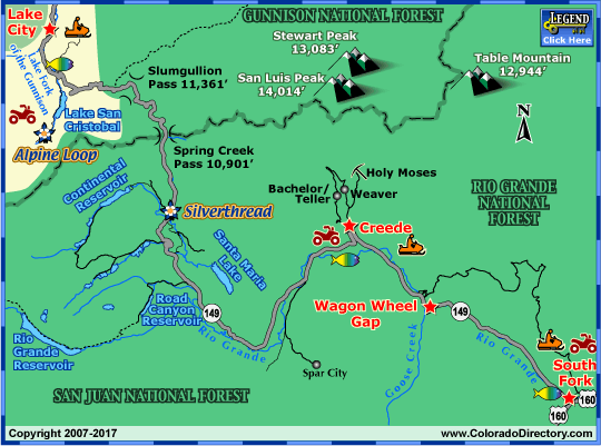
Not all towns appear on map. The publisher does not assume any responsibility for accuracy or completeness of maps. This information was compiled as accurately as possible.
Explore Lake City, Creede & South Fork, Colorado
Year-round, whatever you're looking for, the Lake City area has it.
Want to spend time outdoors? In the summer, four wilderness areas in the region provide quiet, vehicle-free trails for hiking, and both the Continental Divide and Colorado trails pass through the area. Fishermen can choose from a number of rivers, lakes and streams, including Lake San Cristobal - the state's second largest natural lake.
In the winter, the area offers a range of activities from simple snowshoeing to difficult ice climbing. Snowmobile trails traverse the entire area. Lake City, Creede and South Fork combine for nearly 500 miles of track.
For culture-lovers, Creede offers the renowned Creede Repertory Theatre, which has been around for more than 40 seasons. And the Hard Tack Mine in Lake City educates visitors about the region's past with mine tours and a museum.
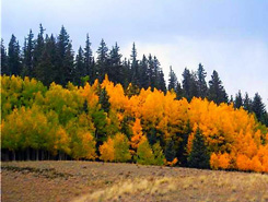
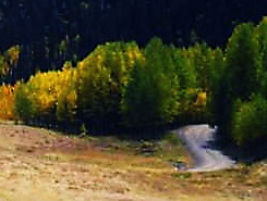
And when visitors run out of things to do, they can simply take in the area's breath-taking scenery. The Pillars of Hercules, volcanic cliffs rising almost 1,000 feet out of the ground, tower over Creede's downtown. And the Alpine Loop and the Silver Thread scenic byways take drivers through some of the state's most beautiful spots.
Lake City Activities & Maps
National Historic Sites and Landmarks:
Slumgullion Earthflow
Scenic Byways:
Alpine Loop Backcountry Byway
Silver Thread Scenic and Historic Byway
Hiking Trails:
The Colorado Trail
Fishing:
Blue Mesa Reservoir & Gunnison River Fishing Map
Lake City Fishing Map
Rafting & Kayaking:
Lake Fork of the Gunnison River Rafting & Kayaking
Jeep & 4WD:
Alpine Loop Backcountry Byway
Lake City, Ouray, & Silverton Jeeping & ATV/UTV Trails
Snowmobiling:
Lake City & Creede Snowmobile Trails
Local Area Maps:
Lake City, Creede, South Fork Area Map
More Activities & Information
Lake City, Colorado includes: Powderhorn

