Local Area Maps, Colorado Local Area Maps, Colorado

Local Area Map
San Luis Valley Area Map


Map of San Luis Valley, Colorado Alamosa, Colorado Wolf Creek Ski Resort, Colorado Great Sand Dunes National Park, Colorado Alamosa Hot Springs, Colorado Northern San Luis Valley Hot Springs, Colorado Rio Grand Area Fishing Map, Colorado South Fork Snowmobile Trails Map, Colorado Chama Snowmobile Trails Map, Colorado Chama, New Mexico, Colorado Antonito, Colorado Conejos, Colorado San Luis, Colorado Los Caminos Antiguos Scenic Byway Map, Colorado Fort Garland, Colorado Blanca, Colorado Capulin, Colorado Alamosa, Colorado Mosca, Colorado Hooper, Colorado Rio Grande Rafting, Colorado Del Norte, Colorado South Fork, Colorado Crestone, Colorado Moffat, Colorado Mineral Hot Springs, Colorado Saguache, Colorado Villa Grove, Colorado Map Legend
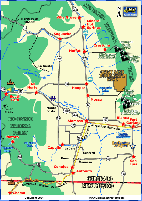
Not all towns appear on map. The publisher does not assume any responsibility for accuracy or completeness of maps. This information was compiled as accurately as possible.

Dirt road inside San Isabel National Forest, Colorado
Taking the Road Less Traveled in the San Isabel National Forest
View of the Sangre de Cristo Mountains in the San Luis Valley, Colorado
San Luis Valley - A National Heritage Area near the Sangre de Cristo Mountains
 

The south central San Luis Valley is rich in culture and history from the Ute Indians and the Spanish who called the valley home. The valley was once home to the Ute Indian Tribe who followed herds and hunted throughout the region. Mexico, then known as New Spain, claimed the valley in the 1600s. The Spanish awarded large sections of land to people wishing to help populate the area. But because of the Mexican War, this process was delayed, and the United States gained control of the area in the mid 1800s. By 1852, Fort Massachusetts, which 6 years later was replaced by Fort Garland, helped stabilize the valley until it was abandoned in 1883. This area was then turned into rich farmland, which is what it is used for today.

The Great Sand Dunes and snow capped Sangre de Cristo Mountain Range, Colorado
The Great Sand Dunes National Park & Preserve
The Great Sand Dunes National Park and Preserve, Colorado, Photo by Michael Hartzog
See the Great Sand Dunes - Only Steps from the Parking Lot
 

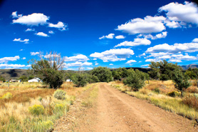
The towns of South Fork, Del Norte, Alamosa, and Antonito, Colorado, and Chama, New Mexico are located in the San Luis Valley. When you really want to get away from it all, this is a great place to vacation, recreate and rejuvenate with geothermal hot springs, hiking the "fourteeners," horseback riding, Los Cumbres Golf Course, or fishing The Rio Grande River. The Crestone Music Festival each August is filled with live music, artisans, healers, food, drinks, fireworks, and fun for all ages. Spread your blanket on the grass while enjoying blues, salsa, rock, bluegrass, country, folk, spiritual, reggae and Celtic music all day.

The San Luis Valley at dawn, Colorado
The Sun Rising in the San Luis Valley
San Luis Valley at dusk, Colorado, Photo by Michael Hartzog
The Sun Setting in the San Luis Valley
 

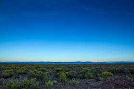
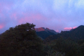
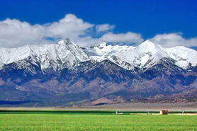
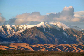
The area is beautiful. With elevation ranging from 7,000' to the 14,345' summit of Blanca Peak, there are many different geological features to explore. The valley is nestled against the magnificent Sangre de Cristo Mountain Range on both the south and east sides. To the north and west, the La Garita and Conejos-Brazos mountain range tower above the valley. It is approximately 125 miles long and over 65 miles wide.

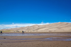
A popular place to visit in the San Luis Valley is the Great Sand Dunes. Bringing about 300,000 visitors a year, the dunes cover 30 square miles and are nestled right next to the Sangre de Cristo Mountains.

San Luis Valley - Northern Activities & Maps

National Parks and Monuments:
Great Sand Dunes National Park & Preserve
Russell Lakes National Natural Landmark

Jeep & 4WD:
Upper San Luis Valley Jeeping & ATV/UTV Trails

Local Area Maps:
San Luis Valley Area Map

More Activities & Information

Antonito, Colorado includes: Conejos, Mogote

Chama, New Mexico

Del Norte, Colorado includes: Monte Vista

Platoro, Colorado

San Luis Valley - Northern, Colorado includes: Crestone, Mineral Hot Springs, Moffat, Saguache, Villa Grove


horizontal rule
Follow Us
Follow us on Facebook Button Follow us on Pinterest Button Follow us on Instagram Button

Places to Stay, Rentals & Amenities
Cabins & Cottages | Motels & Hotels | Lodging & Lodges | Vacation Homes | Condos, Suites & Townhomes | Bed & Breakfast | Tent Camping | RV Parks & Campgrounds | RV Sales, Service & Rentals | Romance Packages | Family Friendly | Pets Welcome | By Water | Swimming Pools | Guest Horses | Groups, Reunions & Retreats | Weddings & Elopements | Winter Lodging

Fun Things to Do
Calendars of Events | National Parks, Monuments & Historic Sites | Scenic Byways & Drives | Fishing & Fly Fishing | Hot Springs | Horse Riding | ATV/UTVing | Jeeping & 4WD | Whitewater Rafting & Kayaking | Attractions | Golfing | Restaurants & Dining | More Fun Stuff | Hunting & Land Leases | Snowmobiling | Downhill Skiing & Snowboarding | Snowshoeing | Cross-Country Skiing

A-Z Towns & Areas | Colorado Maps | About Us

©Copyright 1997- by The Colorado Directory, Inc. This is a directory only; it is not and does not contain a recommendation, warranty, guaranty, inducement or endorsement of any kind. Representations herein were supplied by the individual businesses. The publisher, The Colorado Directory, Inc., does not assume any responsibility for truth, falsity or completeness of any representation made herein or any errors, changes, services rendered, or changes made in the use of this directory. This information was compiled as accurately as possible. Prices and services are frequently subject to change. Errors called to the publisher's attention will be corrected in the future. All rights reserved. No part of this publication may be reproduced, stored or transmitted in any form or by any means, without permission in writing from the publisher.