Colorado National Parks
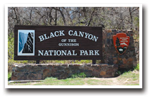
Black Canyon of the Gunnison National Park
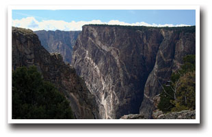
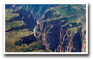
No other canyon in North America combines the narrow opening, sheer walls, and startling depths offered by the Black Canyon of the Gunnison. The beauty of the canyon covers 30,244 acres, or 47.26 square miles, bringing over 173,000 visitors every year. The greatest depth of the canyon plunges 2,722 feet from the top of the walls and stretches 1,500 feet from side to side. These measurements cause sunlight to only briefly illuminate the canyon, hence the name "Black Canyon" of the Gunnison. A geologists dream, the rushing water from the Gunnison River (always visible from the rim) cuts into rocks, some as old as 2 billion years. However, for those not in the field of geology, the Black Canyon provides excitement and activities for everyone.
Rangers are available to give guided walks along the easier trails. Also offered are ranger talks and lunch with a ranger. For children ages 7-12, Black Canyon offers a junior ranger program which gives the child a badge, certificate and pencil after completing the booklet. There are also 4 wheelchair accessible overlooks to enjoy views. Instead of risking the hike down, it is possible drive down to the bottom of the canyon via the East Portal Road. The road is paved and starts near the south rim entrance and the view at the bottom makes an excellent contrast to that at the rim. Hiking along the outer rim of the canyon offers both easy and strenuous trails. There are trails on the North Rim, the South Rim, and on inner-canyon routes that descend deep into the canyon.
When exploring the Black Canyon, you can chose activities from a range of easy to extremely strenuous and dangerous. For the lover of extreme sports, expert rock climbing along the canyon walls is available (pre-climbing and post-climbing registration is required). Hiking in the inner canyon is also possible, though you must obtain a permit from the visitor center before trying this. Only a few people descend the canyon to access the river activities of the raging Gunnison River. Kayaking and whitewater rafting down the wild Gunnison River is an exciting activity for the extreme sport lover.
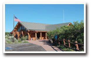
The visitor center also provides academic activities for the whole family. In July 2000, the visitor center added new interactive exhibits to learn more about the park. A digital theater provides two orientation programs for you to become more acquainted with the park. The Curecanti National Recreation Area is also close by.
Downloads:
View an area map of the Black Canyon of the Gunnison
(Map provided by the U.S. National Park Service)
Directions:
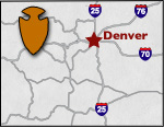
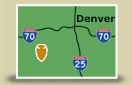
To South Rim: 15 miles east of Montrose, via U.S. Hwy 50 and CO Hwy 347
To North Rim: 11 miles south of Crawford, via CO Hwy 92 and North Rim Road (closed in winter)
Places to Stay & Fun Things to Do
SECLUDED year-round in the Uncompahgre National Forest! Arrowhead Mountain Lodge: Restaurant, bar, UTVing, fishing, snowmobiling. Near the Black Canyon between Montrose and Gunnison off US 50.
Kings is known for Big ROADS and BIG RIGS! RV sites: pull-thrus, riverside, shade, 50 amp. Luxury Park CABINS on the Uncompahgre River. WiFi. Near: Montrose, National Park, fishing, jeeping, restaurants.
More Activities & Information
Grand Mesa Area, Colorado includes: Austin, Cedaredge, Collbran, Eckert, Mesa
Gunnison, Colorado includes: Almont, Blue Mesa Lake, Ohio City, Parlin, Pitkin, Sargents, Sapinero, Taylor Park, Waunita Hot Springs
Montrose Area, Colorado includes: Cimarron, Olathe
National Parks and Monuments in Colorado