Local Area Map
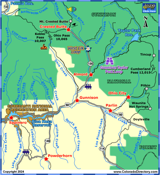
Greater Gunnison Area Map


Not all towns appear on map. The publisher does not assume any responsibility for accuracy or completeness of maps. This information was compiled as accurately as possible.
Ute Indians originally inhabited the area of Gunnison. When Europeans started moving west to start farming and cattle ranching in 1874, the Ute tribe moved west to the Uncompahgre Valley. Five years later, miners struck rich gold and silver deposits, which brought the railroads to the area, and began a boom in the Gunnison area. The area was named for topographer Captain John W. Gunnison who was mapping a railroad route to the Pacific in 1853. But with the demonetization of silver in 1893, much the area became deserted. A few towns survived, and in the 1960s, the Crested Butte Ski Area brought the area back to life.

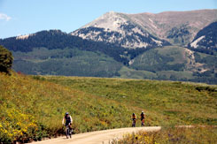
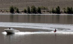
The Gunnison area consists of the towns of Crested Butte & Gunnison. In this area, there are many activities to keep you occupied. Hiking, mountain biking, and hunting are popular. Fishing is another exciting activity. The Lake Fork of the Gunnison & Taylor River are two of the most popular hot spots in Colorado. 750 miles of trout streams run through the area. Many other water activities are available near the many lakes and reservoirs as well.

For downhill skiers, Crested Butte Ski Area offers 1,600 skiable acres as well as the most double-black diamond areas in Colorado. With this to boast, Crested Butte is home to the US Extreme Skiing and Snowboard Championships. With an average of 229 inches of snow each year, this is a great place for other winter sports, including snowmobiling, cross country-skiing, and ice skating.
Curecanti National Recreation Area offers many recreational activities for those wanting to experience the outdoors.
Gunnison Activities & Maps
National Parks and Monuments:
Black Canyon of the Gunnison National Park
Blue Mesa Reservoir/Curecanti National Recreation Area
Scenic Byways:
Gunnison Taylor Park Loop Scenic Drive
Silver Thread Scenic and Historic Byway
West Elk Loop Scenic Byway
Seasonal Attractions:
Cattlemen's Days
Fishing:
Blue Mesa Reservoir & Gunnison River Fishing Map
East River Fishing Map
Taylor River Fishing Map
Rafting & Kayaking:
Gunnison River Rafting & Kayaking
Lake Fork of the Gunnison River Rafting & Kayaking
Taylor River Rafting & Kayaking
Jeep & 4WD:
Crested Butte & Gunnison Jeeping & ATV/UTV Trails
Hot Springs:
Gunnison Hot Springs
Snowmobiling:
Crested Butte & Taylor Park Snowmobile Trails
Gunnison Area Snowmobile Trails
Salida & Monarch Snowmobile Trails
Local Area Maps:
Greater Gunnison Area Map
More Local Information
Gunnison, Colorado includes: Almont, Blue Mesa Lake, Ohio City, Parlin, Pitkin, Sargents, Sapinero, Taylor Park, Waunita Hot Springs


